Pioneering Unmanned Solutions in the Flint River Valley
Welcome to the Bainbridge operations center for Fair Lifts Unmanned Aerial Services. Situated in the fertile heart of the Georgia Coastal Plain, we believe the marriage of cutting-edge robotics and local agricultural wisdom is essential for a thriving regional economy. Bainbridge is far more than the "Bass Capital of the World"; it is the strategic engine of Decatur County’s industrial and farming prowess. From the sprawling peanut rotations in Climax to the emerging logistical hubs along the US-27 corridor, Fair Lifts provides the high-tech scaffolding that allows local enterprises to optimize, scale, and outperform.

Our philosophy is centered on a singular goal: converting raw aerial data into operational intelligence. For far too long, "drone work" has been synonymous with simple photography—visually pleasing but functionally hollow. Fair Lifts is redefining the category. We have transitioned the Unmanned Aerial Vehicle (UAV) from a creative novelty into an indispensable piece of industrial infrastructure. With a foundation built on aviation safety and sophisticated project oversight, every deployment for a Bainbridge partner is conducted with surgical accuracy and a nuanced understanding of our specific regional climate.
Integrated into the Fabric of Southwest Georgia’s Landscape
In Decatur County, the land is our legacy. Our local producers cultivate some of the most vital corn, cotton, and peanut acreage in the Southeast. However, the unique "Red Dirt" and sandy loam of the Coastal Plain, combined with the intense humidity of the Flint River valley, create a volatile environment for traditional machinery. Sudden afternoon deluges can render fields inaccessible to heavy tractors, allowing pest and fungal pressure to explode while equipment sits idle. Fair Lifts serves as your "Aerial Intervention Team." Our heavy-payload spray drones operate when the ground is too saturated for wheels, ensuring that critical nutrients and crop protection reach the canopy at the exact moment of peak efficacy.
Our mission extends beyond the furrow to the stewardship of our local ecosystem. The Flint River and Lake Seminole are the lifeblood of our region, requiring a sophisticated approach to conservation. Our environmental wing specializes in the precision eradication of invasive species like Cogongrass and Chinese Tallow, eliminating the need for heavy ground equipment that compacts soil and disturbs fragile habitats. Utilizing survey-grade multispectral sensors, we identify infestations with sub-inch accuracy, ensuring our applications are as environmentally responsible as they are effective. We aren’t just flying over Bainbridge; we are investing in its longevity.
Engineering-Grade Geospatial Intelligence
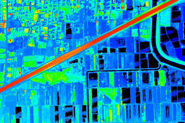
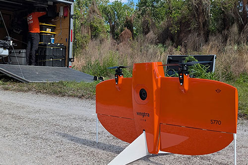
As Bainbridge experiences new industrial and residential growth, the requirement for high-fidelity, rapid-turnaround geospatial data has never been higher. Whether it is a new manufacturing site near the Port of Bainbridge or a complex corridor inspection for regional energy providers, there is zero tolerance for inaccuracy. Fair Lifts Survey & Mapping Services delivers the absolute vertical and horizontal precision required for rigorous engineering standards. Leveraging Blue UAS-certified platforms such as the WingtraOne Gen II and Riegl LiDAR technology, we penetrate the dense South Georgia pine canopies to map the terrain beneath with incredible detail.
Our commitment to Decatur County includes a fierce dedication to data sovereignty. In a landscape of evolving digital threats, we prioritize the confidentiality of regional infrastructure data. Our Blue UAS status confirms that we meet the Department of Defense’s stringent criteria for secure supply chains and end-to-end data encryption. When we map a local utility grid or a Southwest Georgia pipeline, your proprietary data is safeguarded from takeoff to final delivery. We provide more than just digital models; we provide the security of professional, government-grade intelligence.
We invite you to discover how Fair Lifts is reshaping the horizon and the profitability of Bainbridge, GA. Our collective of project managers, agronomists, and Part 107 pilots is ready to solve your most complex logistical hurdles. In Decatur County, we don’t just observe the landscape; we master it from the sky.
Regional Impact
Local Rapid Response
Our Bainbridge-based crews are ready for immediate deployment, providing 24-hour mobilization for Decatur, Miller, Seminole, and Grady counties.
Request Local Response
Ready to Start Your Project?
Discuss your specific goals in Bainbridge with a regional expert. We provide rapid mobilization and precision scoping for every regional client.