Strategic Data for Decisive Southwest Georgia Operations
As Bainbridge solidifies its position as a vital inland hub for logistics and industrial growth within the Coastal Plain, the requirement for pinpoint accuracy in geospatial data has never been higher. For civil engineers, land developers, and environmental specialists in Decatur County, conventional surveying often falls short of the rapid pace required by modern construction and resource management. Bainbridge Ag Drones represents a technological leap in how land is measured. We move beyond simple "drone photos" to deliver sophisticated geospatial intelligence that serves as the definitive baseline for your project's most complex requirements.
Our methodology is designed to eliminate the most common friction points in regional land development: expensive estimation errors, safety hazards on active work sites, and the logistical delays of ground-based crews. Utilizing a sophisticated fleet of Blue UAS-certified aircraft, we capture millions of hyper-accurate data points across vast landscapes in a fraction of the time required by traditional methods. Whether you are auditing inventory at a Bainbridge limestone quarry or surveying a multi-mile utility expansion through the river basin, we provide high-resolution results that integrate directly into your existing CAD and GIS ecosystems.
Secure Data via Blue UAS Standards
In an era of heightened digital risk, safeguarding your site’s data is a non-negotiable priority. Every system utilized by Bainbridge Ag Drones is Blue UAS Certified, meaning they have cleared the rigorous cybersecurity and supply chain protocols established by the U.S. Department of Defense. For those overseeing critical infrastructure in the Bainbridge area—including municipal water systems and regional energy grids—this certification guarantees that your proprietary data remains protected from the moment of capture to final delivery.
Volumetric Analysis: Stockpile Certainty
For the industrial and mining operations of the Coastal Plain, precise inventory management is the difference between profit and loss. Relying on manual "walk-up" measurements is not only time-intensive but exposes personnel to unnecessary risks on shifting stockpiles and steep embankments. Bainbridge Ag Drones removes the hazard while significantly increasing the data density. Our 61MP high-resolution sensors capture every contour of your site to build high-fidelity 3D models.
By processing this imagery through PIX4Dmatic—the gold standard for large-scale computation—we generate auditable reports on cut/fill quantities and stockpile volumes with centimeter-level precision. For financial controllers and operations managers in Decatur County, this provides a transparent, verifiable record of assets. We transform your physical site into a measurable digital asset that can be analyzed and shared across your leadership team within 24 hours of the flight.
LiDAR Mapping: Seeing Through the Coastal Canopy
The landscapes surrounding Bainbridge are defined by the dense timber and thick undergrowth characteristic of the Georgia Coastal Plain. For many engineering projects, traditional photogrammetry is unable to "see" the ground through the pine canopy. When you need an unobstructed view of the terrain beneath the trees, our LiDAR (Light Detection and Ranging) services are the solution. We utilize the Riegl miniVUX-2UAV, a premier sensor engineered specifically for high-accuracy vertical mapping.
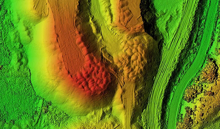
LiDAR operates by emitting millions of laser pulses that penetrate even the most stubborn vegetation, reflecting off the soil to create a "bare earth" Digital Terrain Model (DTM). This is an essential tool for Bainbridge developers navigating floodplain requirements or engineers designing complex drainage systems near the Flint River. Our LiDAR deployments achieve absolute vertical accuracy of better than one inch, revealing the hidden topography of Decatur County that other aerial methods simply cannot detect.
Expansive Surveys & Multi-Platform Coordination
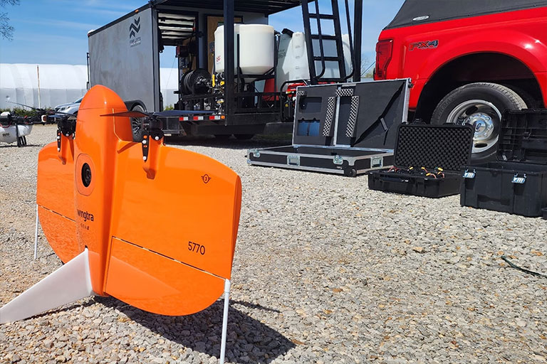
Regional infrastructure often demands a massive sense of scale. Standard quadcopters lack the flight time to cover large territories, while manned aircraft are often cost-prohibitive for routine monitoring. We bridge this gap with the WingtraOne Gen II, a high-endurance fixed-wing VTOL aircraft capable of mapping over 700 acres in a single mission—ten times the efficiency of standard drones. For the largest developments in Southwest Georgia, such as new industrial corridors or sprawling timber tracts, we coordinate multiple crews for simultaneous deployment.
This parallel approach allows us to map thousands of acres in a single day without any loss in data resolution. With integrated PPK (Post-Processed Kinematic) technology, every data point is geotagged with centimeter-level precision, drastically reducing the need for manual ground control. This results in a faster project lifecycle and a smaller physical footprint on your site, providing a comprehensive dataset ready for immediate GIS integration.
3D Modeling & Site Digital Twins
Bridge the gap between a blueprint and reality with photorealistic 3D digital twins. Traditional 2D maps often fail to capture the full spatial context of a complex development project. Bainbridge Ag Drones creates immersive, high-definition 3D models that allow stakeholders to virtually "walk" the site, providing a level of clarity that flat images can't replicate.
By fusing top-down and oblique perspective imagery, we generate textured meshes and point clouds that serve as a permanent "as-built" record. This technology is a game-changer for monitoring construction milestones, conducting drainage studies, and marketing prime commercial real estate in Decatur County. A digital twin offers a verifiable, time-stamped record of earthwork and structural progress, ensuring that the physical build remains perfectly synced with the engineering design at every stage.
Technical Accuracy Metrics
Horizontal Accuracy
1.0 cm
PPK-Verified Accuracy
Vertical Precision
< 2.5 cm
LiDAR Terrain Accuracy
Ground Sampling Distance (GSD)
0.7 cm/px
MAP61 Full Frame
Managed Workflow
Your dedicated Bainbridge Project Manager oversees the entire technical workflow, from sensor selection to data processing in Pix4Dmatic. We deliver actionable results in the precise formats your engineers require, including DXF, DWG, LAS, and GeoTIFF files.
Request Technical Scoping